Tasmanian Weather Systems: What They Look Like — and Mean — on the Ground
When planning or guiding trips in Tasmania’s high country, forecasts often refer to “cold fronts,” “high pressure,” or “troughs.” These terms come from Bureau of Meteorology synoptic charts, but understanding what they mean in practical terms is what matters when you’re standing on an exposed ridge or committing to a multi-day traverse.
Tasmania sits in the path of the Southern Hemisphere westerlies, exposed to Southern Ocean air masses while also influenced by the shifting subtropical ridge. Small changes in large-scale weather patterns can produce rapid and significant changes on the ground. Reading these systems correctly helps inform timing, route choices, and risk management.
This overview explains how the main weather systems typically present in the Tasmanian wilderness and how they affect travel decisions.
Always cross-check forecasts with official BOM guidance and current park alerts.
1. Cold Fronts: Rapid Change and Exposure Risk
On the synoptic chart
Cold fronts appear as blue lines with triangles indicating advancing colder air, typically linked to low-pressure systems tracking eastward across the Southern Ocean.
On the ground
Ahead of the front:
Strengthening northerly winds.
Mild or warm conditions, often dry in summer.
Increasing cloud or unstable skies.
During passage:
Abrupt wind shift, commonly turning south-westerly.
Rapid temperature drop.
Dense cloud bands with rain or showers.
Strong gusts in exposed terrain.
Behind the front:
Colder, showery air with intermittent clearing.
Hail or snow possible at elevation during strong outbreaks.
Operational impact
Cold fronts significantly reduce safe exposure margins on ridgelines and open plateaus. Visibility may drop quickly, wind chill rises sharply, and wet clothing rapidly increases hypothermia risk. Post-frontal clearing can improve navigation but often coincides with freezing overnight temperatures.
Plan crossings and exposed sections with frontal timing in mind.
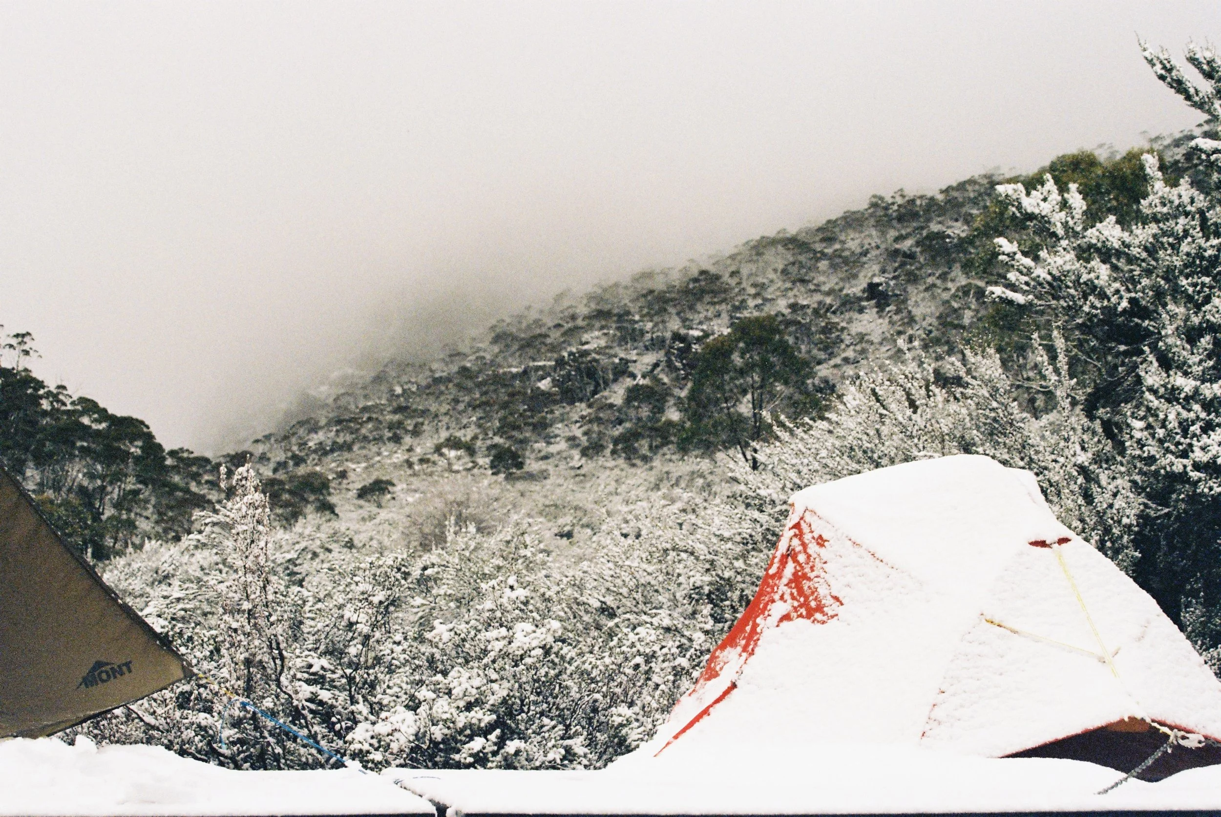
Snow-covered alpine camp after a cold front, showing how quickly conditions can shift in Tasmania’s high elevations.
2. High Pressure Systems: Stability with Hidden Cold
On the synoptic chart
Marked by an “H” surrounded by closed isobars. Winds near the centre are typically light, reflecting stable atmospheric conditions.
On the ground
Clear skies and good visibility.
Light winds or calm conditions.
Strong overnight cooling producing frost and frozen surfaces.
Morning valley fog common.
Under strong winter highs, temperatures below −10°C have occurred in Tasmanian highlands.
Operational impact
High-pressure systems often provide the most predictable travel windows. However, stable clear skies increase overnight heat loss, making camps significantly colder than many walkers expect. Frozen ground and icy surfaces increase fall risk early in the day.
Favour early starts after sun exposure rather than pre-dawn departures in icy conditions.
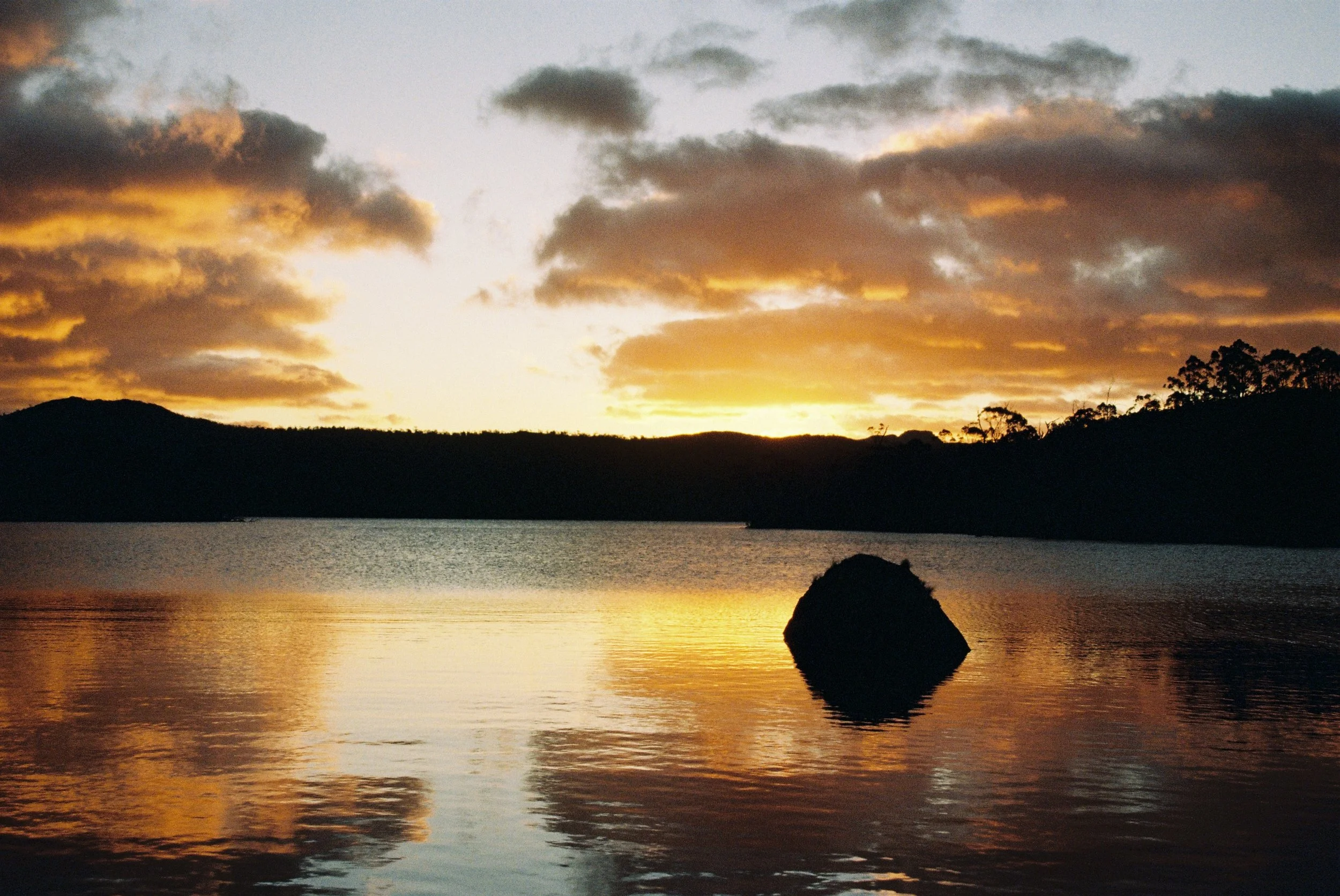
High-pressure stability at sunset — light winds, clear visibility, and fair-weather cumulus typical of settled conditions.
3. Low Pressure Troughs: Gradual Deterioration and Uncertainty
On the synoptic chart
Shown as dashed lines indicating elongated zones of lower pressure without a defined centre.
On the ground
Progressive cloud thickening through the day.
Variable or strengthening winds.
Increasing humidity and persistent dampness.
Patchy showers developing, occasionally intensifying.
Operational impact
Troughs reduce predictability. Conditions may remain manageable or deteriorate quickly depending on embedded systems. Persistent moisture reduces drying opportunities and increases fatigue over multi-day travel.
Expect conditions to evolve and reassess frequently.

Cloud-filled alpine basin under trough conditions, showing deteriorating visibility and increasing instability.
Seasonal Context: Blocking Highs and the Tasmanian Pattern
During summer, the subtropical ridge shifts southward, allowing high-pressure systems to sit closer to Tasmania. These patterns often produce extended settled periods with clear skies and light winds, though cold nights remain common at elevation.
In winter, the ridge retreats northward, leaving Tasmania more exposed to the prevailing westerly flow. Frequent cold fronts and rapidly changing conditions become the norm, reducing prolonged stable weather windows.
Understanding this seasonal shift helps explain why summer trips may feel more predictable, while winter requires constant awareness of incoming systems.
Why This Matters
Tasmania rarely stays stable for long. Cold fronts drive rapid change, high pressure creates valuable but cold weather windows, and troughs introduce uncertainty. Recognising these patterns — through wind shifts, cloud development, and temperature trends — allows better timing decisions and safer travel.
Check the BOM MSLP chart before departure, compare model trends, and plan conservatively.
Safe trails,
Edward